OpenATS stands for open-source Air Traffic Surveillance, delivering services centered around its innovative open-source
software. Specializing in air traffic surveillance data processing systems, which include sensors and tracking solutions, our company
collaborates with Air Navigation Service Providers (ANSPs), airports, and system manufacturers to ensure the highest level of surveillance and operational safety.
We aim to extend the operational safety margin beyond what international or custom standards mandate through rigorous analysis, configuration, and compliance verification of Radar, MLAT (Multilateration), ADS-B (Automatic Dependent Surveillance-Broadcast), and other related tracking systems. Please refer to our Evaluation Services page for further information.
The OpenATS COMPASS Client, our main open-source project, is designed to analyze and verify surveillance data for various airspace applications, including Area Control Center (ACC), Approach (APP), Tower (TWR), Departure (DEP), and Ground (GND). It is freely available for anyone to use, enhancing transparency and accessibility in air traffic surveillance.
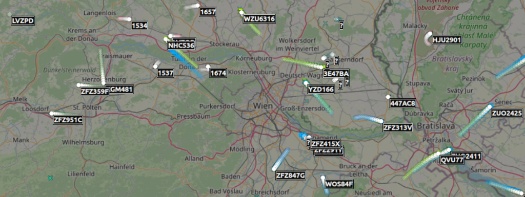
The COMPASS Portal is the web companion to the OpenATS COMPASS Client. It exposes processed surveillance data over the intranet, drives the Client backend through scheduled jobs, and aggregates results across weeks of recordings into trend dashboards. Designed for stakeholders who require convenient, shared access to analysis results without running the COMPASS Client themselves.
While the software itself is free, we offer specialized commercial services such as custom feature development, dedicated support, and professional training sessions. For further information please refer to Why Open-Source?
jASTERIX, our second open-source project, allows converting EUROCONTROL ASTERIX data to the JSON format, and can be easily integrated into 3rd party solutions.
By making OpenATS COMPASS publicly available as a common standard tool in our field, we enable users to enhance operational safety margins in Air Traffic Control surveillance, facilitating safer skies for everyone.