Its name being an abbreviation for compliance assessment, the OpenATS COMPASS tool allows air traffic surveillance recordings to be imported into a database for analysis, visualization and evaluation.
Many use-cases are supported, e.g. importing EUROCONTROL ASTERIX recordings into a database, textual & visual analysis, evaluation (calculation of performance indicators) and evaluation report document generation.
The application is highly configurable, quite complex and developed for being used by air traffic surveillance professionals. To support new users, a user manual as well as YouTube videos are supplied.
The C++ code is released under the GPL-3.0, while the Linux AppImage and the user manual are released under CC BY 4.0.
OpenATS COMPASS is publicly available and free for anyone to use (including commercial usage), under the previously stated licenses.
Please note that the released C++ code does not include the OSG View (geographical data display), which is included in the released AppImage only.
Features
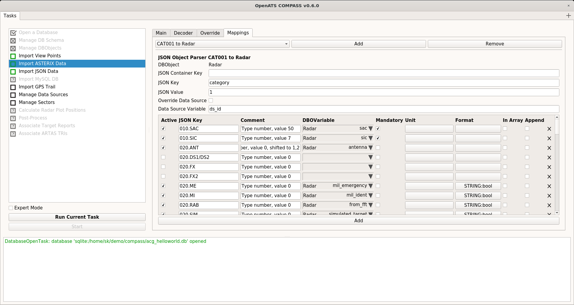
Import
- Use of stand-alone, lightweight SQLite3 database containers
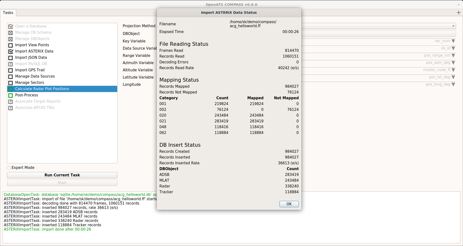
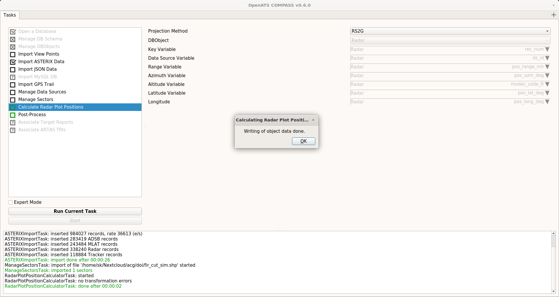
- Offline mode for import of ASTERIX recordings of up to 24 hours
- Live mode for live ASTERIX import from network UDP streams
- Dynamic ASTERIX import using jASTERIX
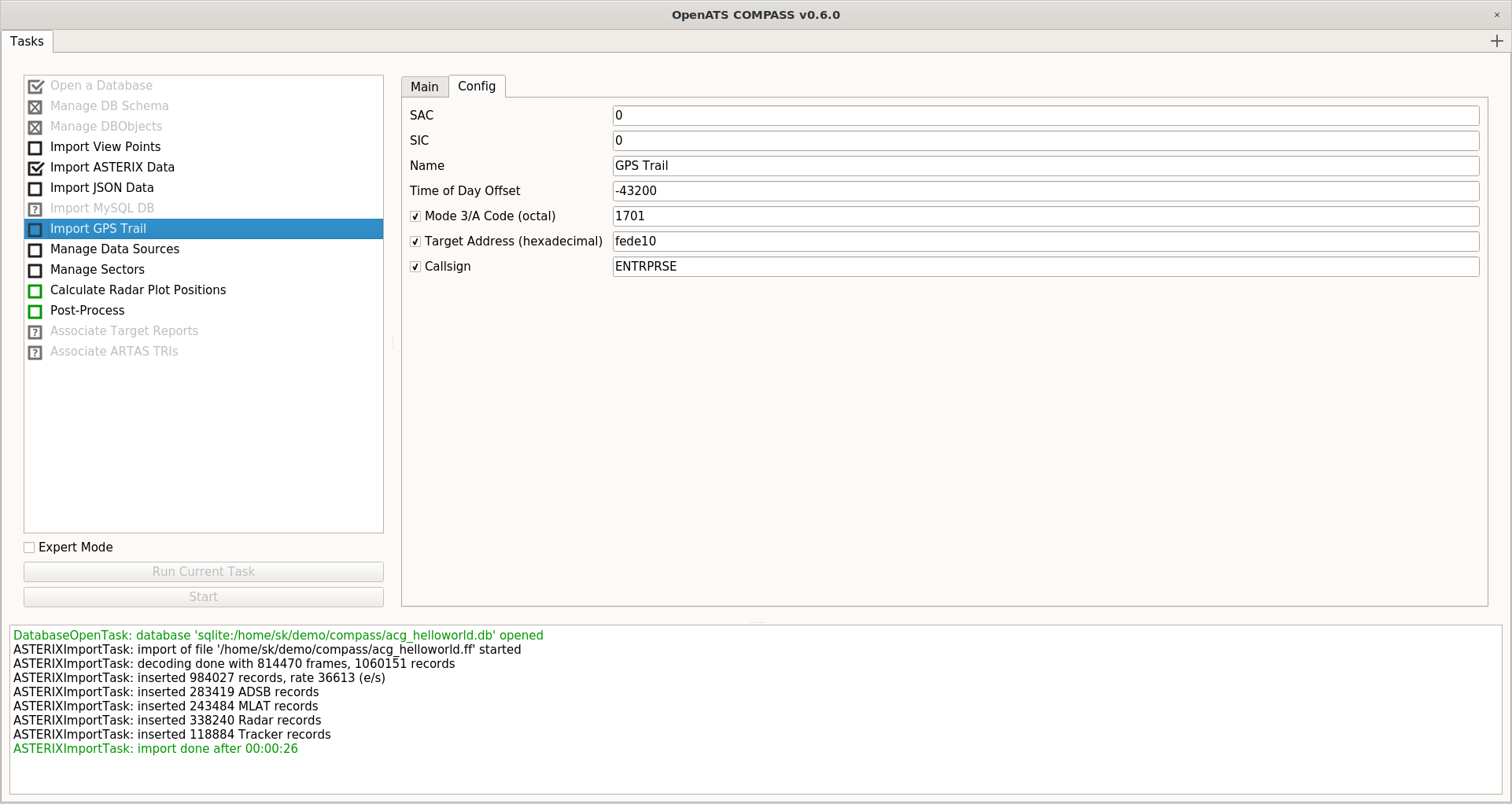
- Import of (D)GPS trails from NMEA files
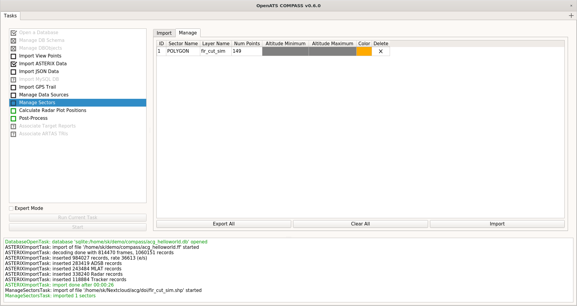
- Import of polygons from GML,KML,ESRI Shapefiles
- Supported Database Objects
- Radar plots
- MLAT & WAM target reports
- ADS-B target reports
- System Track updates
- Reference trajectory updates
Analysis
- High performance processing, low memory footprint
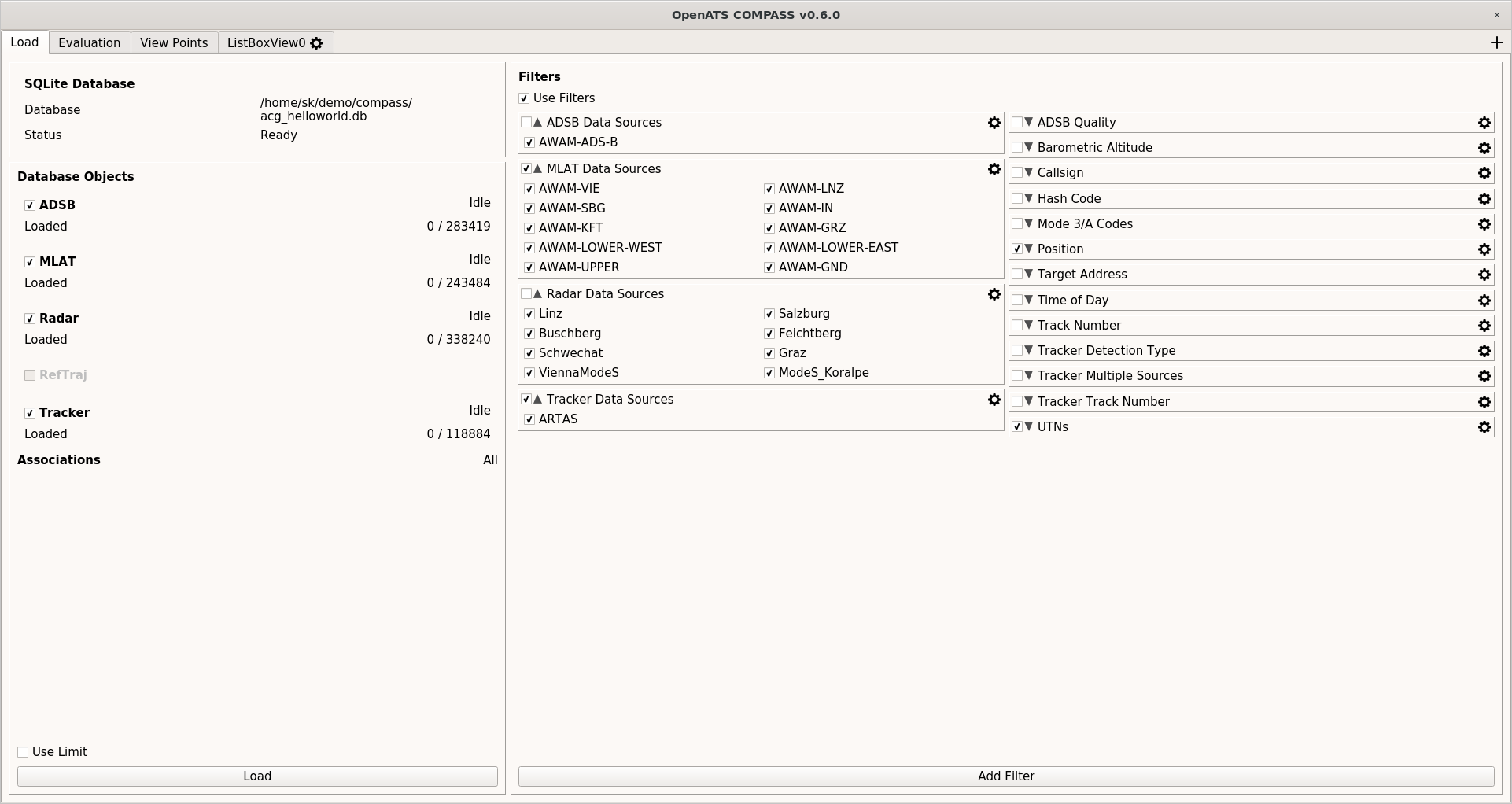
- Filtering for detailed analysis
- Simple custom filter generation
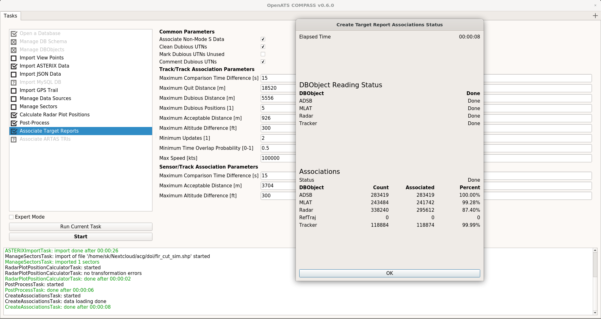
- General target report association (find unique targets)
- ARTAS track association (TRI) analysis
- Textual data inspection using Listbox View
- Display of data as text tables
- Configurable data loading of data of interest
- Exporting of data as CSV
Visualization
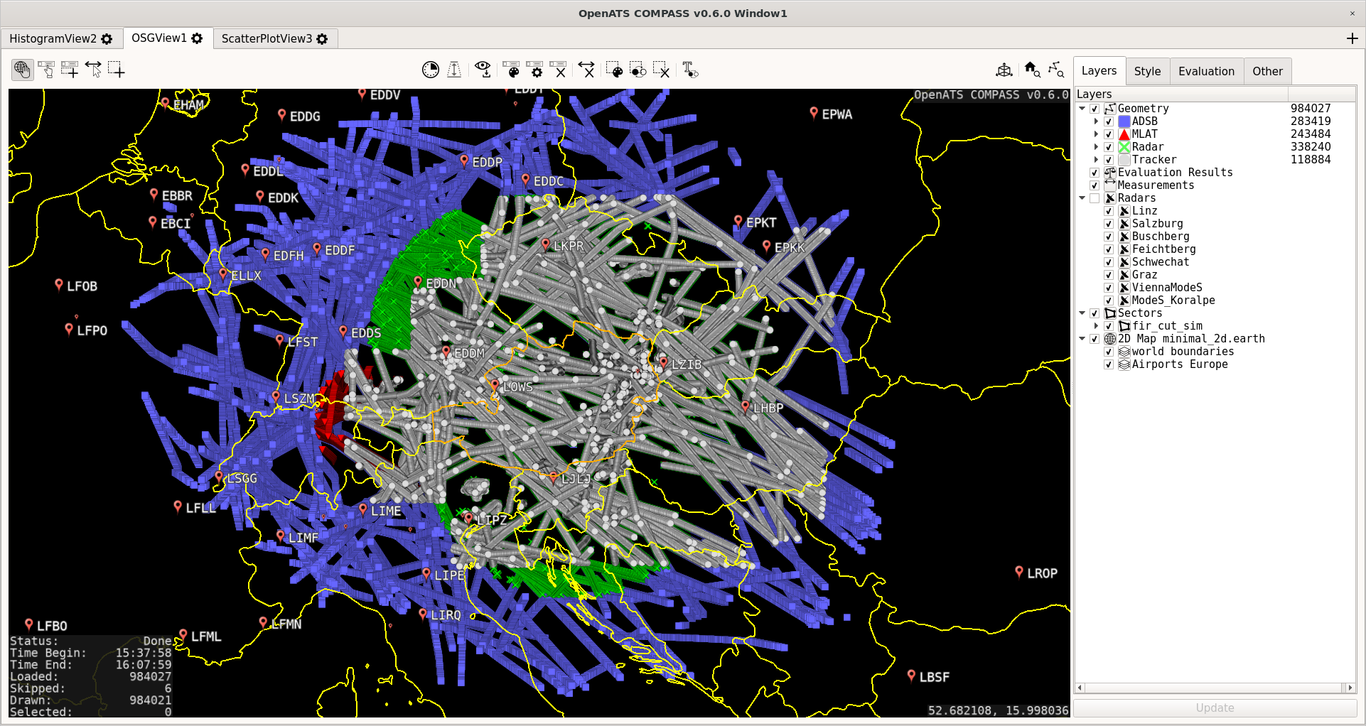
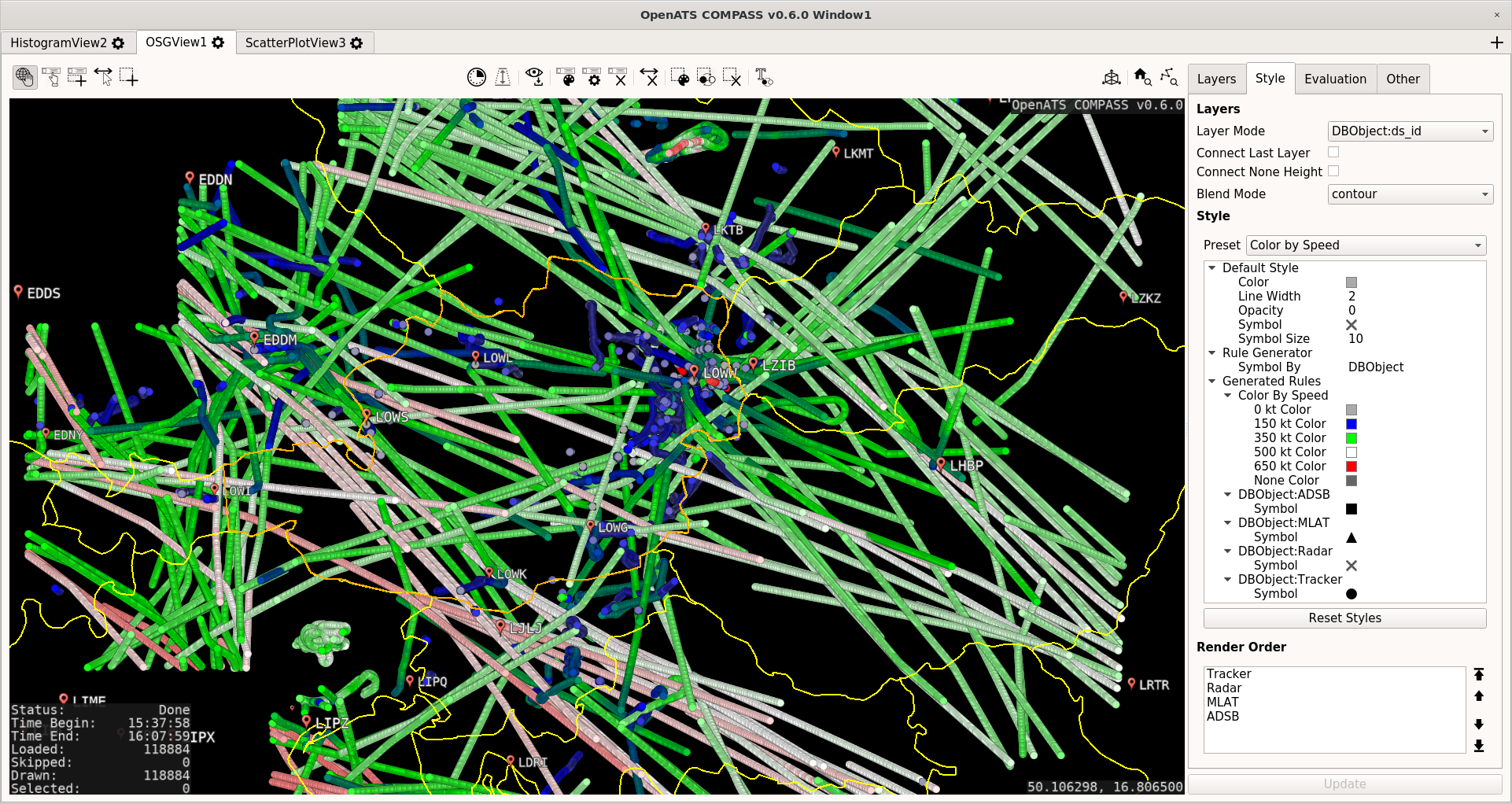
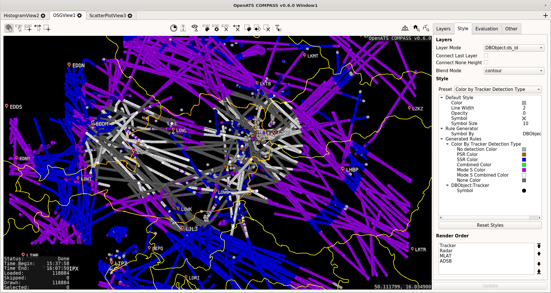
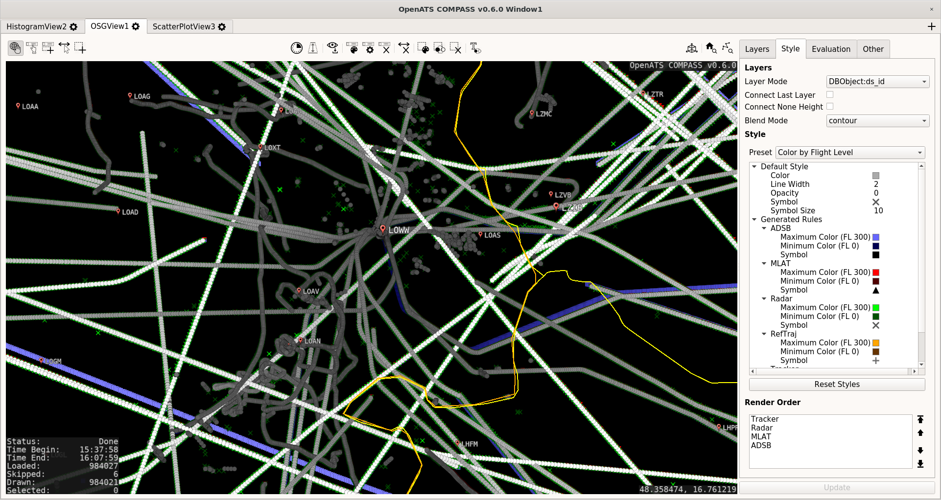
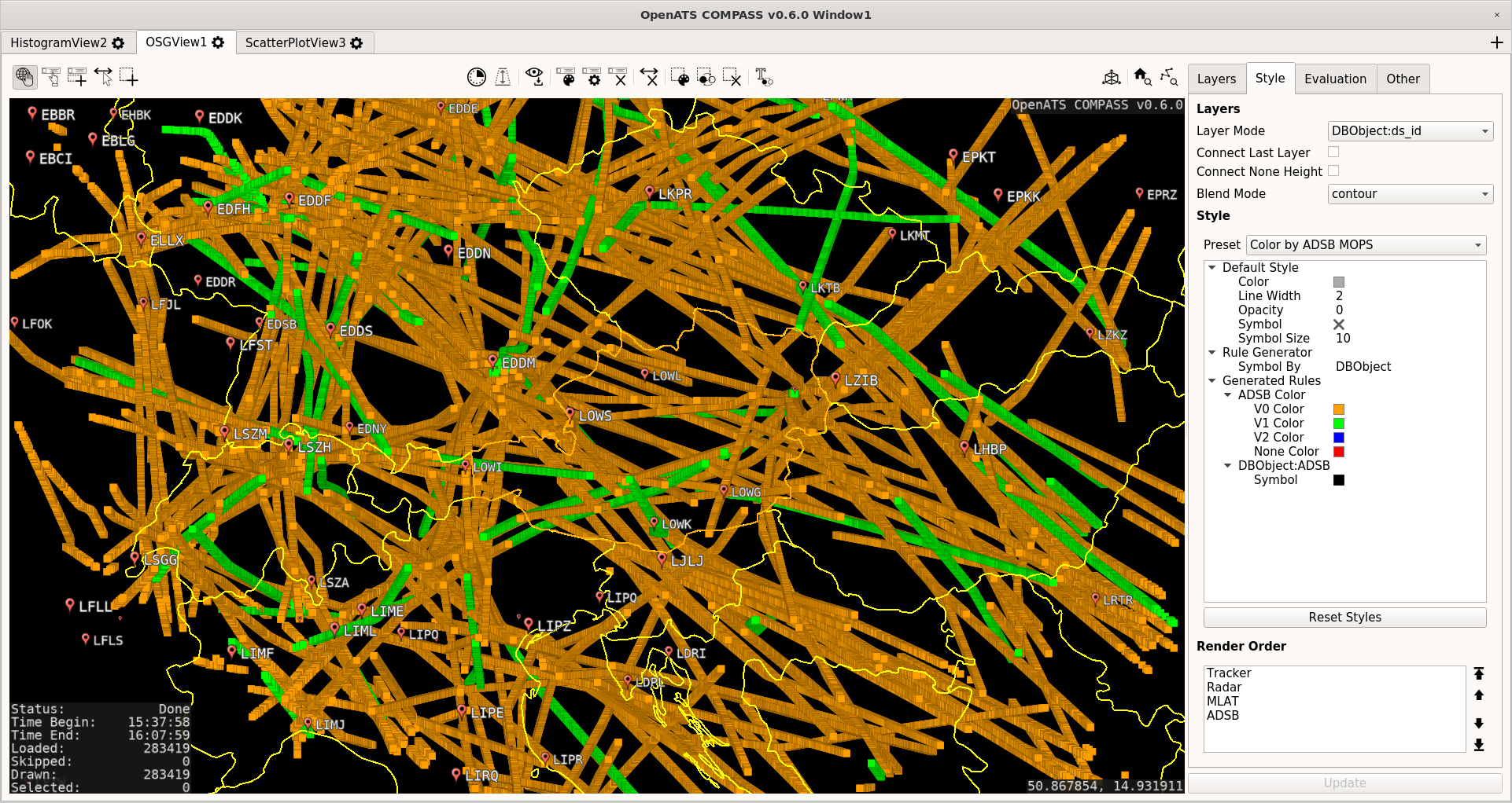
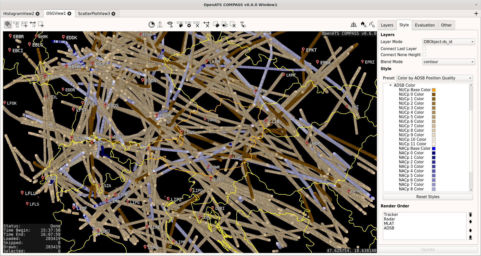
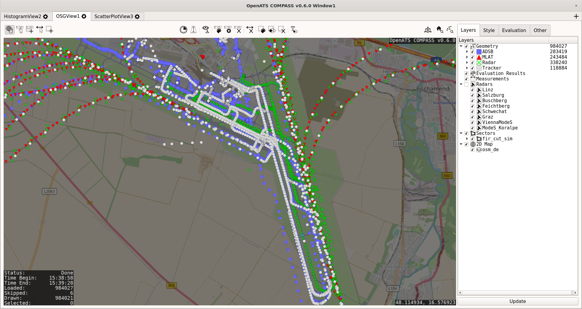
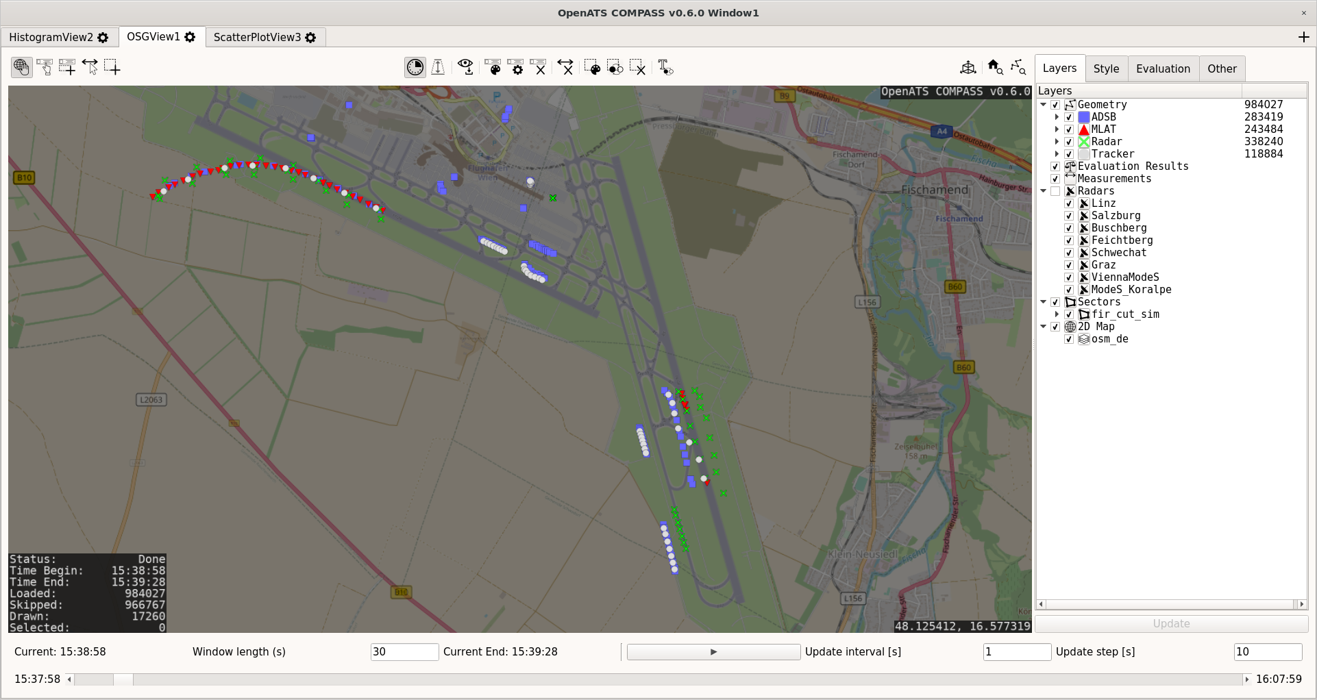
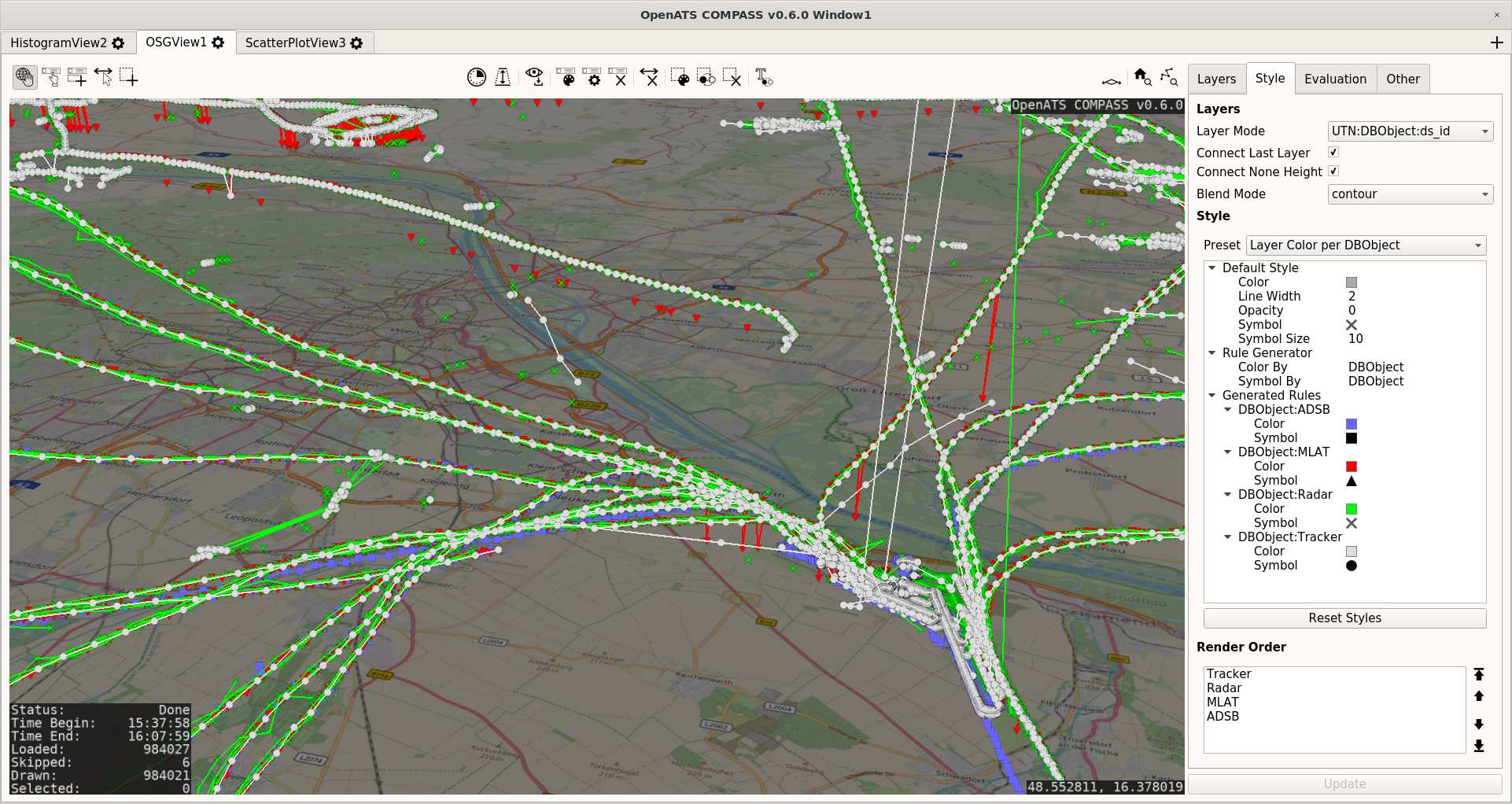
- Graphical data inspection using OSG View
- Customizable map/terrain display based on osgEarth
- Customizable display of ATC surveillance data using OpenSceneGraph
- High-speed time-filtered display
- Numerous operations for analysis, e.g. data selection, labeling, distance measurement
- Configurable data layering and styling for detailed analysis
- Relatively low memory footprint (e.g. 16 million target reports in ~8 GB RAM)
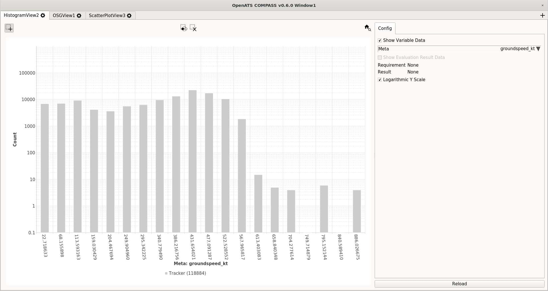
- Data distribution inspection using Histogram View
- Display of any numeric variable or evaluation result as histogram
- Linear or logarithmic axis supported
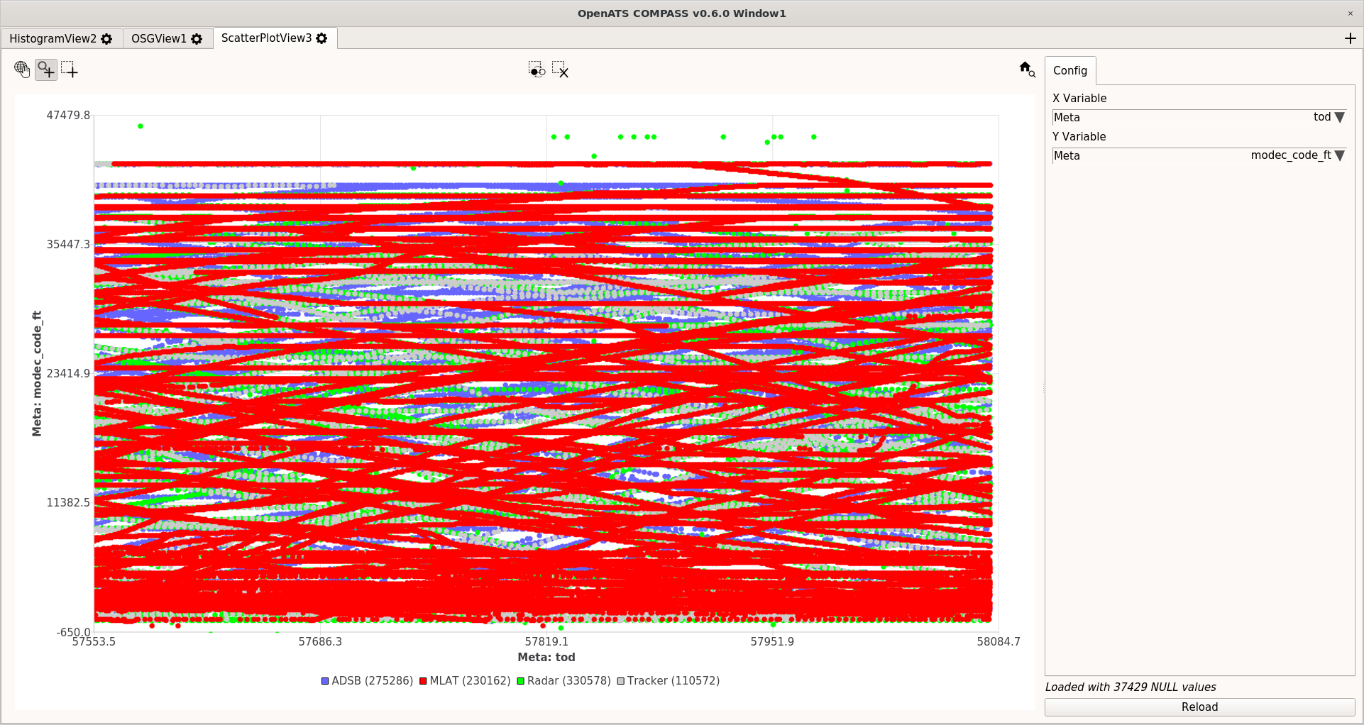
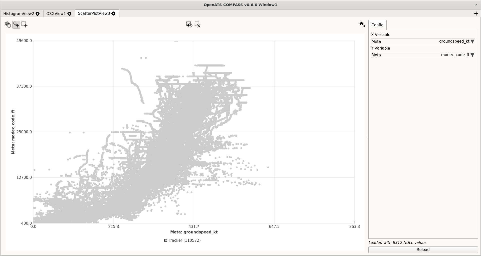
- 2D data distribution inspection using ScatterPlot View
- Display of any 2 numeric variables as X/Y plot
- Cross-view data selection and inspection
- Command line options for automated processing
- View points for efficient inspection
Evaluation
- Calculation of reference trajectories
- e.g. based on filtered ADS-B data
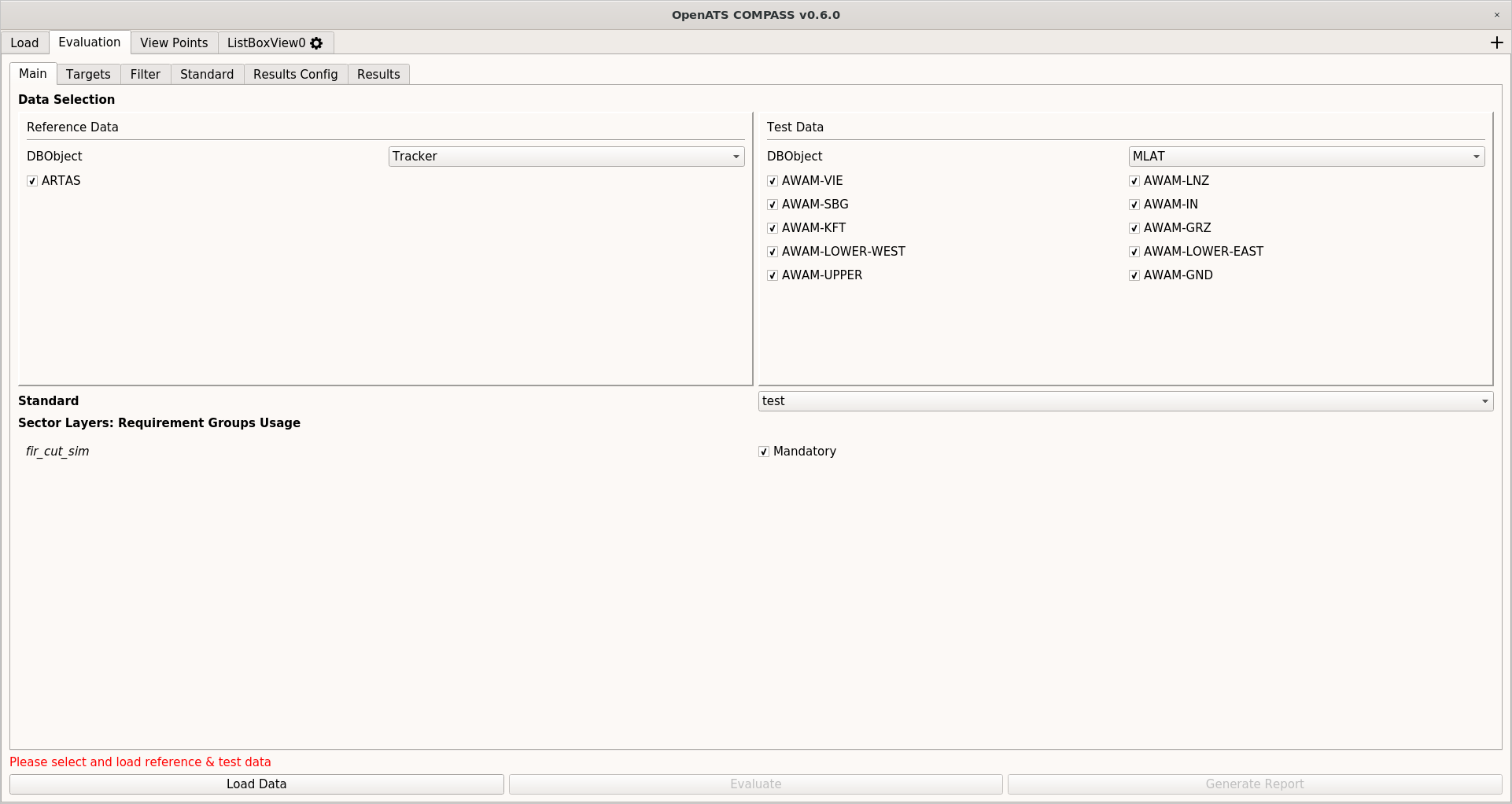
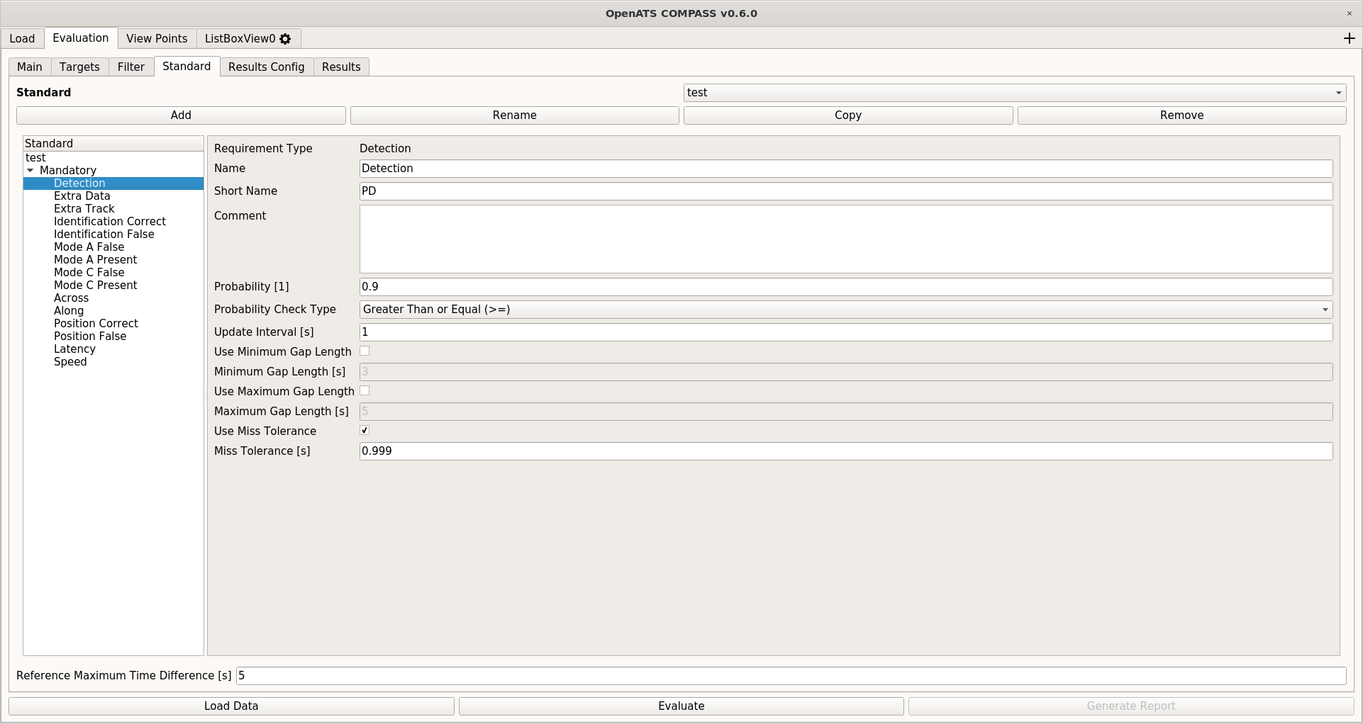
- Standard compliance evaluation
- Definition of standards based on configurable requirements
- Generalized comparison of test data vs. reference data
- Calculation of requirements/performance indicators from e.g.
- EUROCAE ED-87C/D/E (A-SMGCS Tracker)
- EUROCAE ED-116 (SMR)
- EUROCAE ED-117/A (Local MLAT)
- EUROCAE ED-142 (Wide-area MLAT)
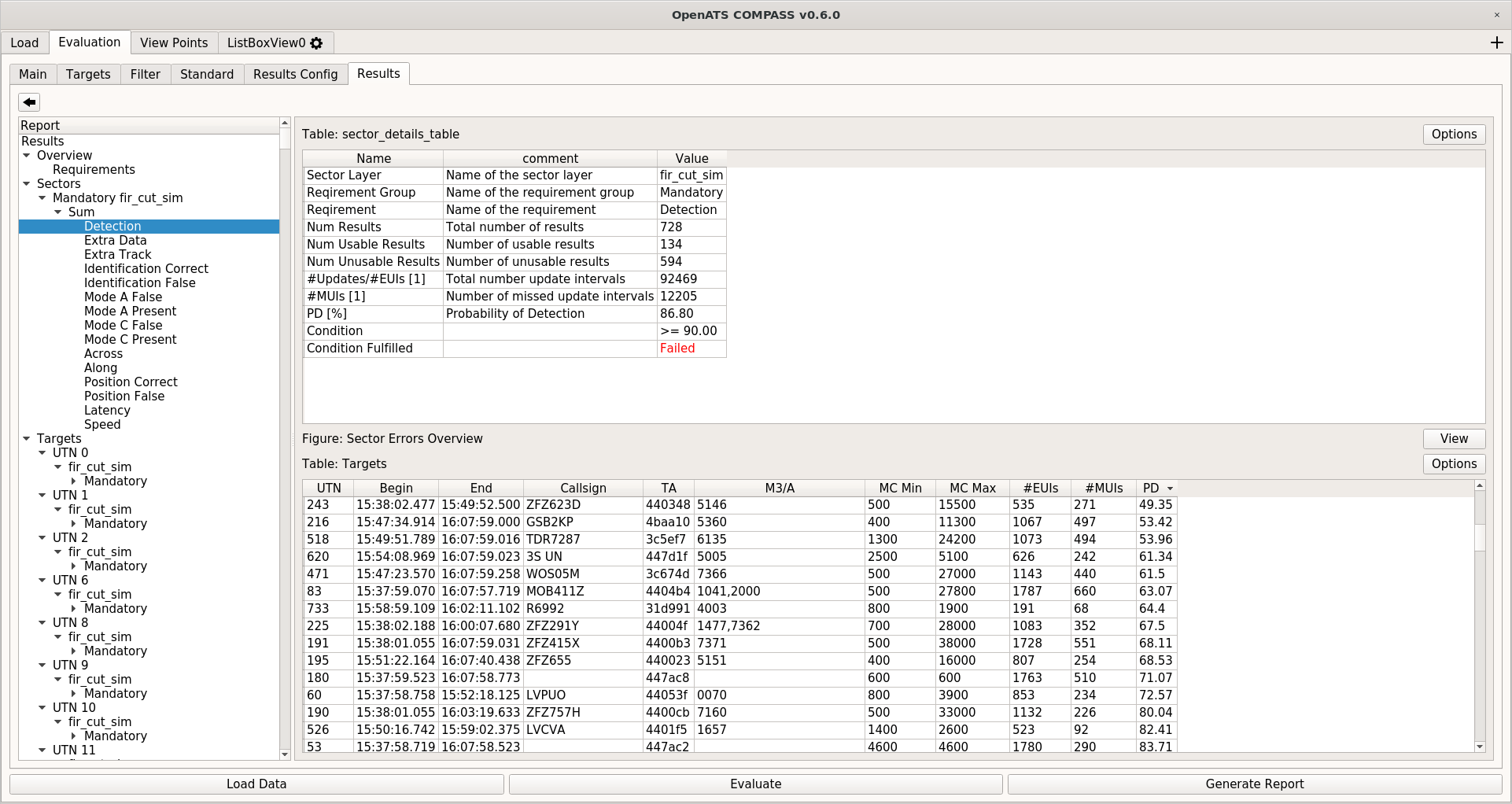
- Investigation/display of results on several levels of detail
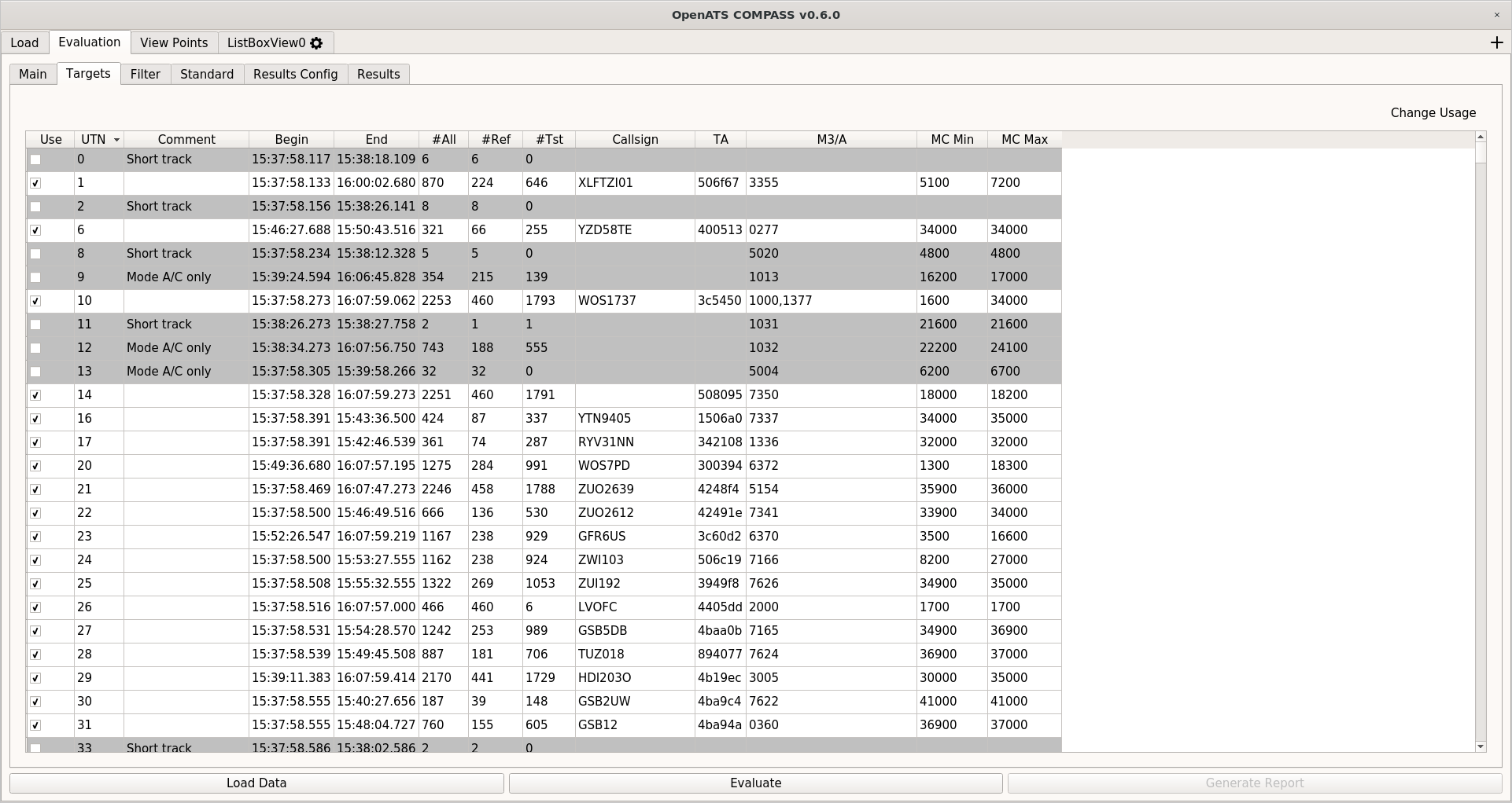
- Automatic removal of targets (short tracks, VFR, …) possible
- Manual removal of specific targets possible
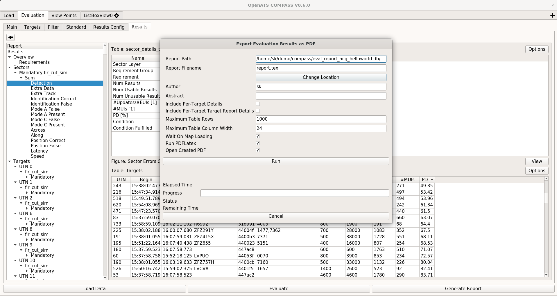
- Export of results as report PDF
Live Mode
- Live ASTERIX import from UDP network data streams
- Up to 4 lines per data sources
- Immediate decoding, insertion into database, display in OSG View
- Air-Traffic Controller HMI-like display
- Filtering based on data sources, network lines, secondary attributes
- Immediate replay of last 5 minutes
Services
We are able to provide services based on OpenATS COMPASS – please refer to our project-related services page for details.
Links
For further information and the software/user manual releases, please refer to the project GitHub site.